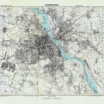
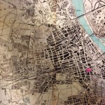
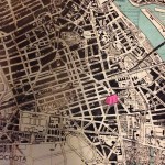
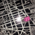
I was introduced to this map of Warsaw earlier this year.* The credit on the map reads, “Drawn by the Geographical Section, Polish General Staff. Photolithographed by the War Office 1944.” It is a map of Warsaw. I’ve tried to do a modern day zoom in on the map by taking progressively tighter photographs of the map at the left. The pink arrow marks the address of 24 Krucza Street – the building where my great-grandfather lived and painted and where the family art supply store existed in the interwar years. I will be standing there a week from today.
If you click on one of the maps, it will enlarge and you can see the details a bit better.
[Hat tip and a thank you to Dr. Waitman Beorn who introduced me to this map! I met Waitman in March 2014 when he kindly invited me to the University of Nebraska, Omaha to come speak both to his class and at the Kaneko.]


